If you look back at presidential electoral maps from the past century, it paints a visual picture of how massive political shifts can occur in relatively short periods of time, even if things often feel set in stone in the present moment. California was a red state until 1992, for example, while Texas went blue …
If you look back at presidential electoral maps from the past century, it paints a visual picture of how massive political shifts can occur in relatively short periods of time, even if things often feel set in stone in the present moment. California was a red state until 1992, for example, while Texas went blue as recently as 1976. Here’s a collection of every Presidential Electoral Map since 1900, many of which are truly unrecognizable today.
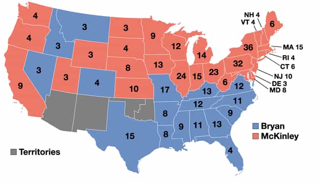
1900: William McKinley vs. William Jennings Bryan
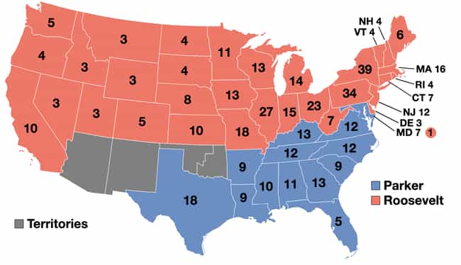
1904: Theodore Roosevelt vs. Alton B. Parker
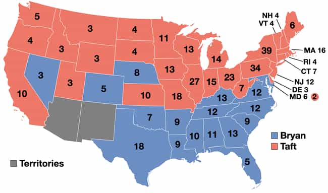
1908: William Howard Taft vs. William Jennings Bryan
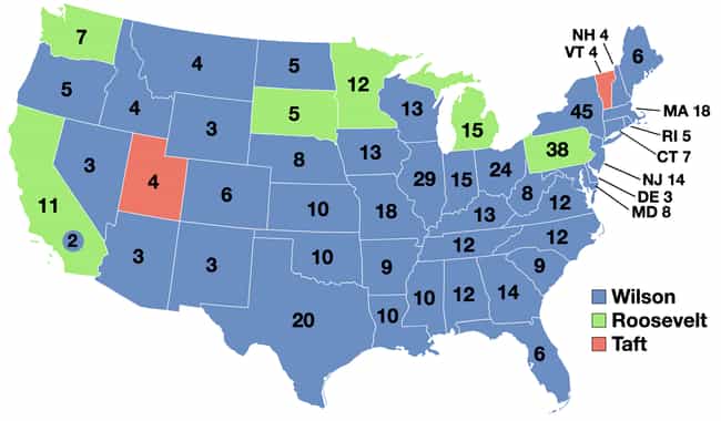
1912: Woodrow Wilson vs. William Howard Taft vs. Theodore Roosevelt
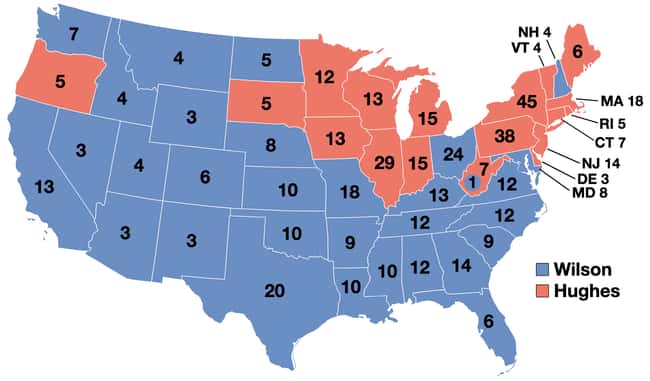
1916: Woodrow Wilson vs. Charles Evans Hughes
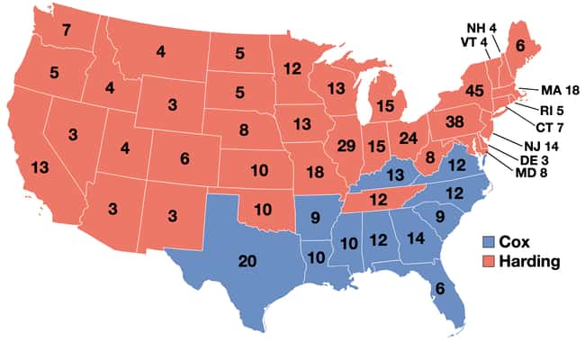
1920: Warren G. Harding vs. James M. Cox
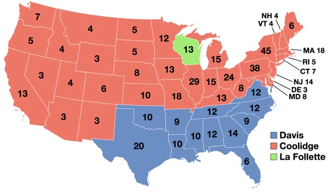
1924: Calvin Coolidge vs. John W. Davis vs. Robert M. La Follette
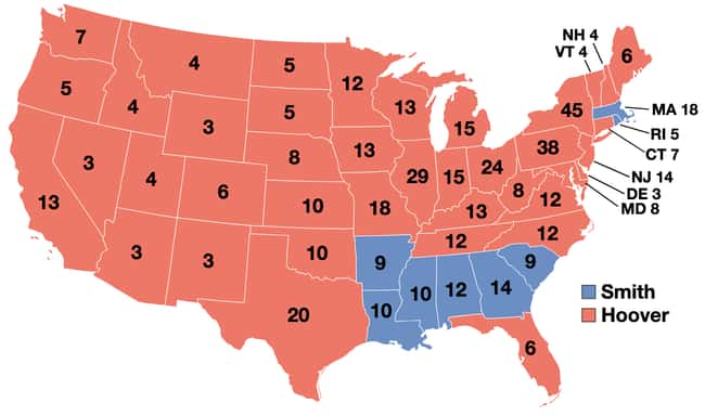
1928: Herbert Hoover vs. Al Smith
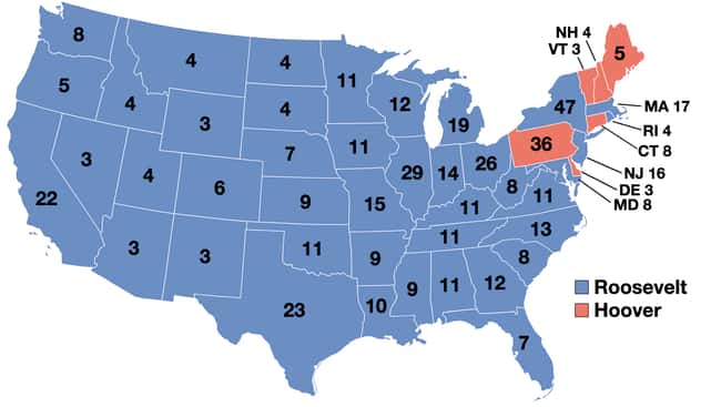
1932: Herbert Hoover vs. Franklin D. Roosevelt
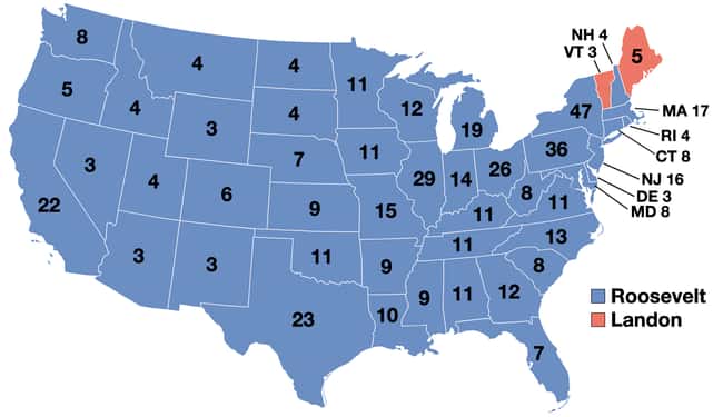
1936: Franklin D. Roosevelt vs. Alf Landon
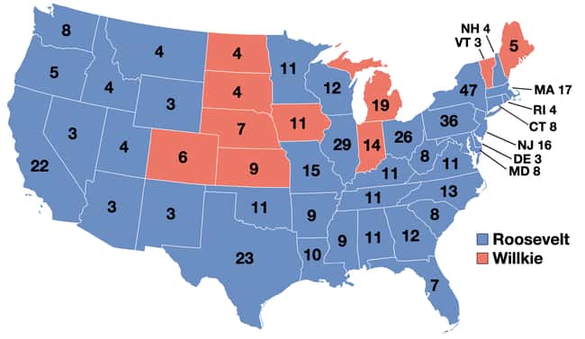
1940: Franklin D. Roosevelt vs. Wendell Willkie
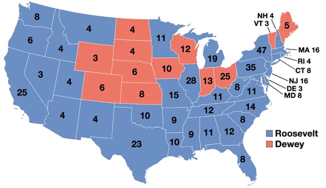
1944: Franklin D. Roosevelt vs. Thomas E. Dewey
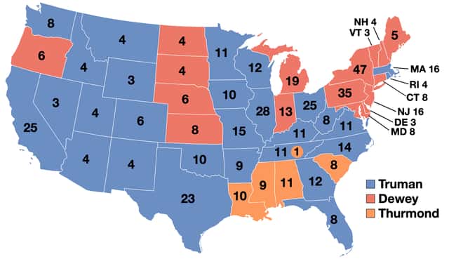
1944: Harry S. Truman vs. Thomas E. Dewey vs. Strom Thurmond
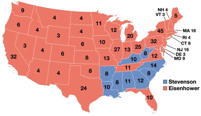
1952: Dwight D. Eisenhower vs. Adlai Stevenson
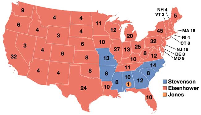
1956: Dwight D. Eisenhower vs. Adlai Stevenson
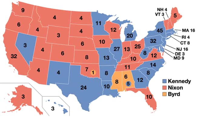
1960: John F. Kennedy vs. Richard Nixon
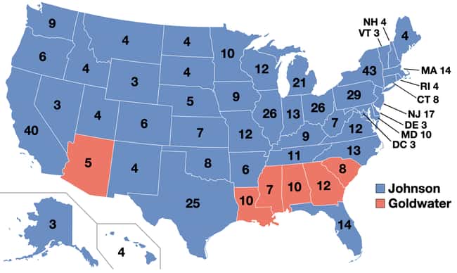
1964: Lyndon B. Johnson vs. Barry Goldwater
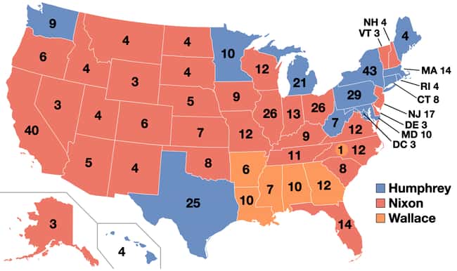
1968: Richard Nixon vs. Hubert Humphrey vs. George Wallace
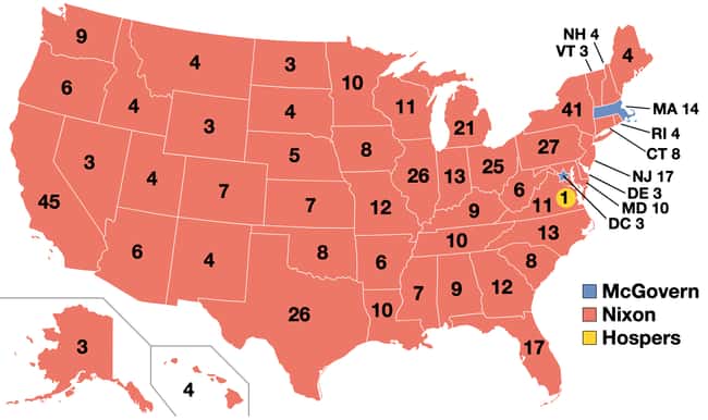
1972: Richard Nixon vs. George McGovern
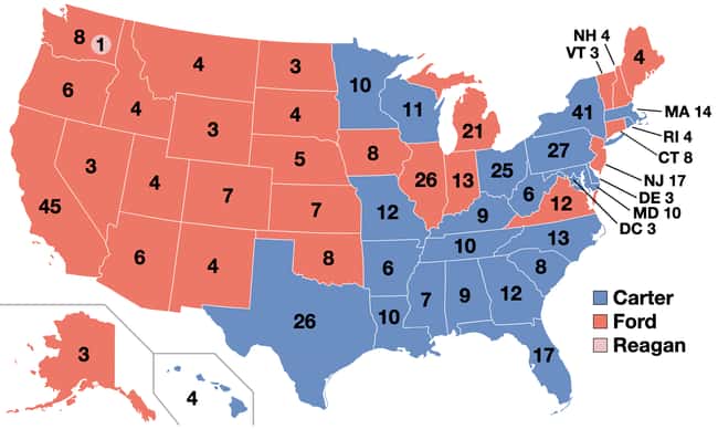
1976: Jimmy Carter vs. Gerald Ford
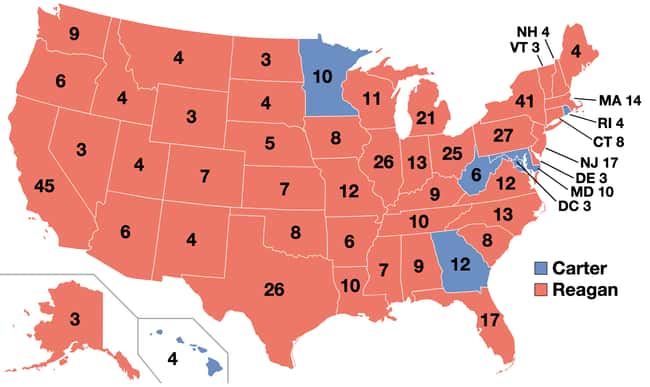
1980: Ronald Reagan vs. Jimmy Carter
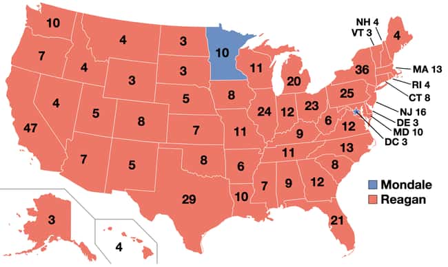
1984: Ronald Reagan vs. Walter Mondale
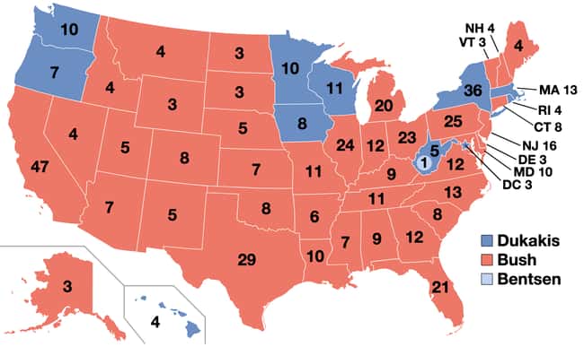
1988: George H. W. Bush vs. Michael Dukakis
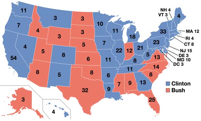
1992: Bill Clinton vs. George H. W. Bush
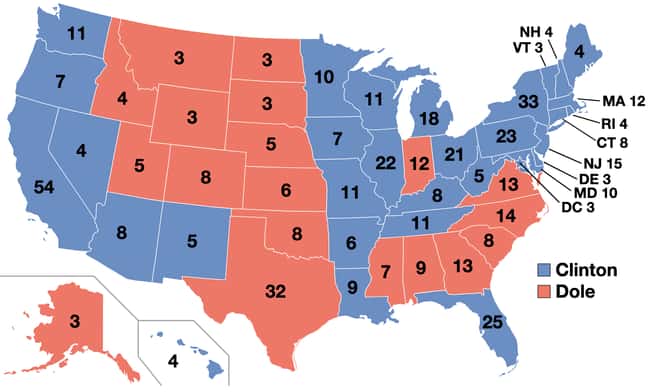
1996: Bill Clinton vs. Bob Dole
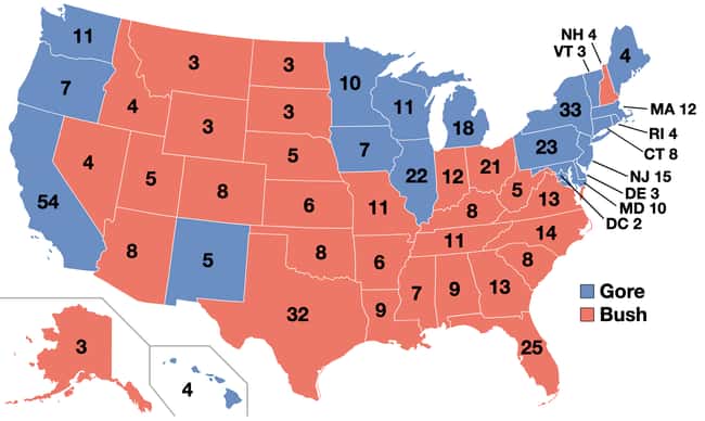
2000: George W. Bush vs. Al Gore
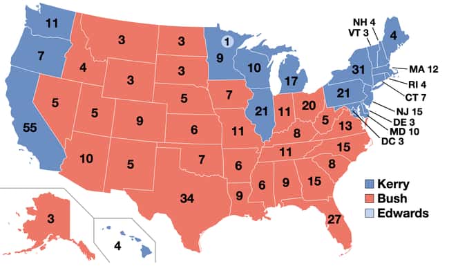
2004: George W. Bush vs. John Kerry
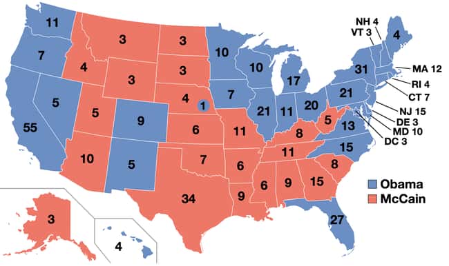
2008: Barack Obama vs. John McCain
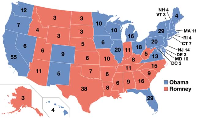
2012: Barack Obama vs. Mitt Romney
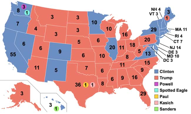
2016: Donald Trump vs. Hillary Clinton